Mapper of the Month: Guy Vanvuchelen
01.12.2014 - Marc Gemis
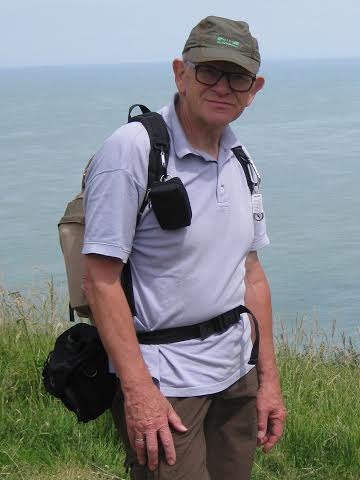
Guy’s username is GuyVV. He is 70 and lives in the area around Tienen. He has worked all his life for a bank. During the last years of his active career he made a lot of statistics, using tools such as Framework, DBase, Excel and Access. He bought his first computer, a MSX, in 1988. A few years later he switched to a “PC”. Although he lost track, he assumes that he already owned 20 different models. He is an amateur photographer since his 16th birthday. Later on, he also made digital videos and recently he is into digital photography. Since his retirement he started to walk, slightly pushed by his wife. After buying a Garmin Etrex, he enjoyed it more since he had something to do; namely recording tracks!
How and when did you discover OpenStreetMap?
While I was looking for free maps for my Garmin, I discovered OpenStreetMap. Almost immediately, I realized that those free maps were often better than the official, expensive maps from Garmin. For this reason I use OSM on my Garmin and with OsmAnd.
What kind of mapper are you and where are you mapping?
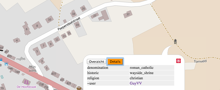
Wherever I go for my walks, typically signposted walks with a club, I make notes. I do not really make structured notes. For this purpose, I use OsmAnd with voice recording. At the moment I try to “write down” the width of roads, the maximum allowed speed, the surface or type of track, the start and end of villages. Furthermore I am interested in all chapels and wayside shrines, so I mark them as well. From time to time I also encounter footpaths (“Trage Wegen”) that are missing. After a walk of 10 kilometers, I have 30-50 minutes of voice recorded notes. From time to time I get some unexpected help from my walking buddies when they let me know beforehand when we are approaching a wayside chapel. They do not really know what I am doing and they think I am only interested in taking a picture.
What do you map and do you have any specialization?
When I started, I thought we should only map roads. I know better now. I’m not specialized in a certain topic, but I will never pass a little chapel without making a note! For awhile, I also collected some address information. I started around my house and walked all the street in the neighborhood. After the arrival of AGIV, I did some couch mapping of house numbers. At this moment I am not sure whether I should continue or now. There has been a lot of discussion on the Belgian mailing list and I do not know whether it is worth the effort to collect the data by surveying.
Why do you map? What motivates you?
I would love to make the map better than the commercial maps, especially around Tienen. I hope that this will make it easier for me convince family and friends to use OpenStreetMap. One of the problems I see at the moment is that the data for car navigation are not complete enough and therefore people do not start using it. Most mappers are mapping from walking or cycling perspective and seem less interested in that type of data. Let me explain this a bit more. I drive with a caravan behind my car. Therefore I do not want to drive along small roads where it is difficult to pass a car from the opposite direction. My TomTom does not help me in this case. Therefore I want to add the width or the number of lanes in OpenStreetMap, so that in the end the map is better than the commercial ones.
Do you do other things related to OpenStreetMap?
Not really, only an occasional attempt to convince friends.
What are your ideas about expanding the OpenStreetMap community? How can we motivate more people?
It is still to difficult for people to start contributing. This is partly due to the lack of documentation in Dutch. I think that meeting on a regular basis for small groups of people could be very helpful. We could stimulate, learn together, etc.
What is in your view the greatest strength of OpenStreetMap?
The data that is available for hikers and cyclists, e.g. via Garmin maps
What are the biggest challenges for OpenStreetMap?
To bring the car navigation on the same level and to keep all data up-to-date
To conclude, is there something else you want to share with the readers?
Start simple. Take one topic, study the documentation and focus on that for awhile