Mapper of the Month: Pierre Parmentier
20.03.2015 - Marc Gemis
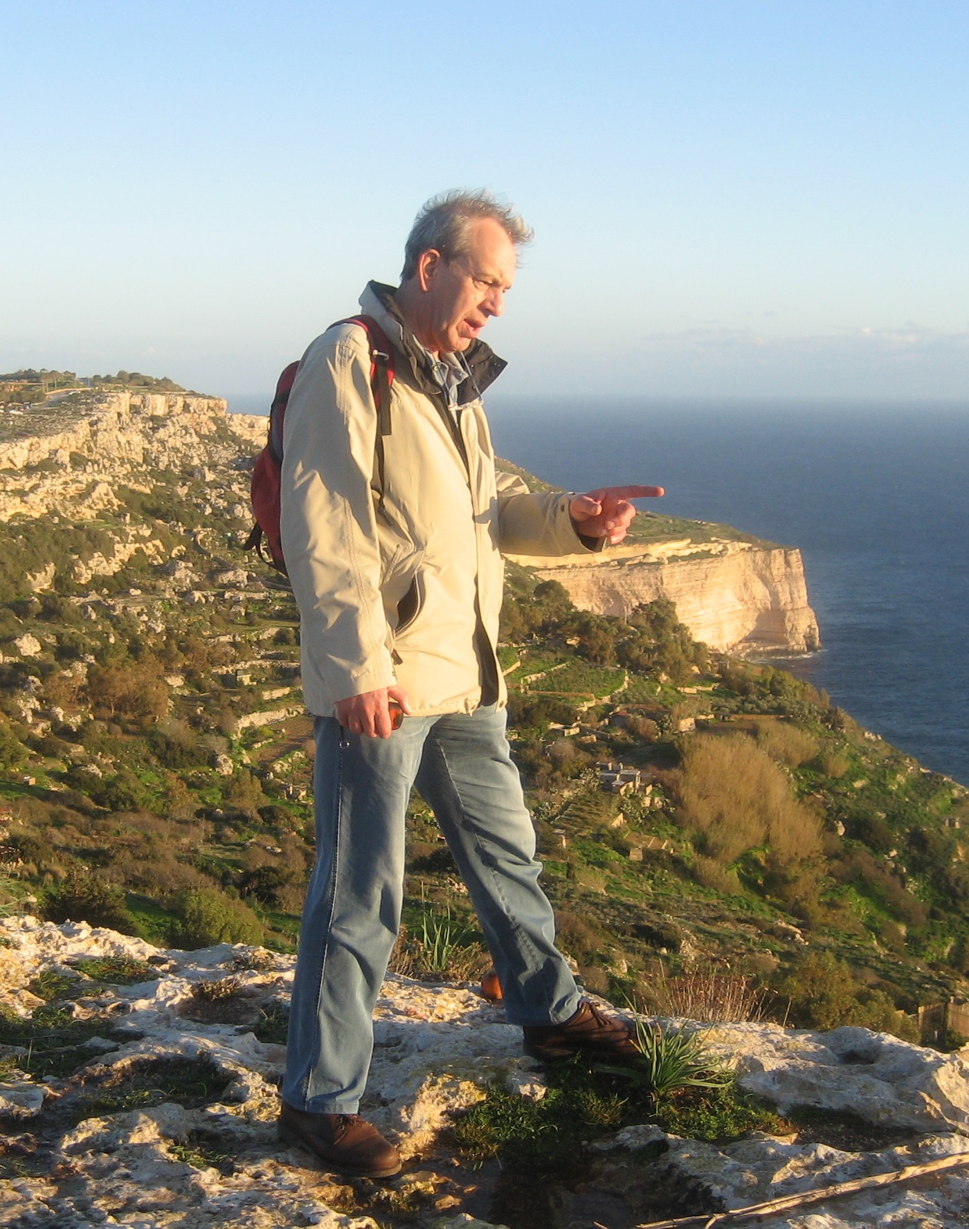
Pierre Parmentier is an engineer in construction. He first worked on construction sites and projects in Africa, the Middle East and South America. Then in Belgium. Currently, as freelancer, he participates in industrial projects in different countries of the world. Everything what has to do with mapping, orienteering and fortifications are his hobbies. And many other subjects! He maps under the name foxandpotatoes.
How did you get to know OpenStreetMap?
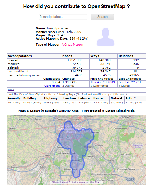
That was in 2009. I completed the highway network in the Sonian Forest. Then, everywhere I stayed, where I went, where I worked, like in Saint-Quentin, in Montmédy, traveling, on vacation, around Brussels, I completed the data. I also call upon my memory of living overseas.
Do you use OpenStreetMap?
OpenStreetMap helps me to prepare travels and to locate points of interest. For editing, I use JOSM and validation tools like Osmosis and OSM Inspector. As GPS, I have a Garmin Etrex 20 and I use OsmAnd+ with my smartphone. I also started to ‘play’ with uMap.
How do you map?
I am a rather isolated contributor. I never had the opportunity to attend a mapping party. I work mostly on places I know. But with validation tools, I can do more distant corrections.
What do you map?
I work mostly on basic data like highways, buildings, the UrbIS import, addresses and shops. Occasionally, I added roadside trees, hydrants, AED, pedestrian crossings, post boxes.
Why do you map?
What motivates me is the passion for maps, the desire to understand the landscape and my environment. When I see a forested embankment in the countryside, I imagine immediately the railroad passing by. Mapping leads to many questions: history, geography, semantics. That’s what interests me! But also participating in a worthwhile project is important for me.
What is your biggest achievement as mapper?
Nothing in particular. We are like ants and each contributor adds his small piece. And each contribution deserves respect!
What are your ideas about expanding the OpenStreetMap community?
I think we should focus on what OpenStreetMap can make a popular tool for the one that moves, including people outside of major cities. Adding bins and lighting, is of course included in the project, but it should come later. Yes, we could add, for example, all the underground networks, useful in public works, but this should not be a priority for now. Furthermore, it is unfortunate that in Belgium, we are not a real ASBL-VZW with a legal personality. Such an organisation will increase our visibility and we could turn to the press and the media more easily. We have for example seen how OpenStreetMap France has become in recent years a public actor with a considerable weight. I also think we should prepare and distribute paper leaflets explaining the nature of the Belgian project. The brochure is available in Dutch; it must only be adapted and also prepared in French and English.
What is in your view the greatest strength of OpenStreetMap?
The greatest strength of OpenStreetMap is to be free. Opportunities to use and reuse are endless. Look at all those ideas and applications that are popping up everywhere, such as the Humanitarian OpenStreetMap Team (HOT), Waymarked Trails, the Geschichtkarten.. All this is very stimulating!
What are the largest challenges for OpenStreetMap?
OpenStreetMap must take advantage of the current trend to put everything on maps, to go graphical. It is a quite recent phenomenon.
How do you stay on top of news about OpenStreetMap?
I read the mailing lists Talk-be and Newbies.
Do you have contact with other Mappers?
No, very little, but I have met contributors in Leuven, Gent and Brussels, at the FOSDEM and at ESI.
To conclude, is there something else you want to share with the readers?
To the Belgian contributors, I say ‘Hats off to you’. To the user of our data, I would say … join us and become a contributor