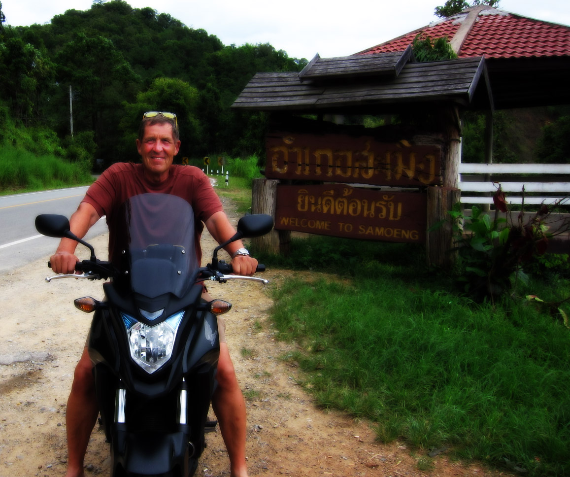
Mapper in the Spotlight: Dave Swarthout (USA/Thailand)
19.11.2015 - Marc Gemis
Who are you?
I might start by saying that at age 72 I have a very nice life, especially now that I’m retired. I’m an American who lives in Chiang Mai, Thailand, for about 8 months of the year with the reminder spent in the United States. I met a fine Thai woman named Nut during my first visit and we’ve been together ever since. I have children and grandchildren living on both the east and west coasts of the U.S, in North Carolina and Oregon, while the rest of my immediate family is in New York State. I spend summers in the little town of Homer, Alaska, where I moved in 1983. I dearly love tennis and often play three of four times per week. In fact, it was my love of tennis that motivated me to exchange Alaska’s cold, dark, and notoriously long winters for the warmer climate of Thailand five years ago. I have many friends there and Alaska is a fantastic place to be in the summer so I simply cannot leave it behind permanently. That’s also why I settled on AlaskaDave as my OSM nickname. I was trained as a chemist and got a BS degree back in 1971 but I became disenchanted with the corporate world and left it behind in 1975. Since then I’ve been a carpenter, school teacher, bread baker, radio announcer, computer programmer, web designer, librarian, and commercial fishing broker. During the summer I continue to work at a business I helped start and whose website I designed, Alaska Boats & Permits, Inc., a commercial fishing brokerage. The website is simple by today’s standards but it has served us well for many years and continues to do so: http://alaskaboat.com
I have been a map lover, a cartographophile, for my entire life. During the years before personal computers became common I bought many of the gorgeous topgraphical maps printed by the U.S Geological Survey and feasted visually on them for places to visit, trails to hike, and places to go hunting. These maps, especially the shaded relief ones, are beautiful and quite artistic to my eye. When Google Earth hit the streets I was literally dumbfounded. I spent countless hours gazing at the stunning aerial imagery of places I had visited, places I loved: the Adirondack Mountains in New York, Cape Cod in Massachusetts, Baxter Park (Maine), and of course, my beloved Alaska. Google made it possible to contribute data to improve those maps and I did that for a while. But the process was slow and there was no way to get a map for your own use from Google, for example, to put onto a GPS device. There still isn’t. Consequently, for many years making my own maps in any way, shape or form seemed quite out of reach. OSM changed all that.
When and how did you discover OpenStreetMap?
After I retired from my brokerage job in 2009 I began to travel extensively and wanted Garmin maps for the countries I planned to visit. Since acquiring my first GPS, a Garmin eTrex in 2005, I’ve recorded traces of every hike, bicycle ride, and automobile trip I made and wanted to have good routable GPS maps for Thailand, Cambodia and Laos where I traveled by motorcycle. However, I couldn’t justify paying $100 USD to Garmin for each of them so I began to look around the Internet for alternatives. I discovered the “Free maps for Garmin brand GPS devices” site at http://garmin.openstreetmap.nl/ and was very impressed with the OSM-derived maps of Thailand available there.
After using those maps for a couple of years I discovered the OpenStreetMap site and learned that a person could upload GPS tracks and from them create highways which could then be added to the OSM database. My first addition to OSM was a GPS track of 208 points on October 6, 2012. Using it I traced a series of connected roads I had ridden on my motorcycle that follow the west shore of Lake Phayao, roads that had not been present on any map before my ride. When I downloaded a new version of the Thailand map a week later, there it was; “my road” was on it. From that point I was hooked.
What do you map?
Given the level of detail lacking in parts of my places of interest, I wish I could map everything. Time constraints prevent me from doing as thorough a job as I would if I had only a single area to deal with but I live in two countries (Alaska is as big as many countries), both of which need tons of work. At first I mapped only the easier stuff because both Thailand and Alaska have many areas that are practically empty of OSM objects; I concentrated on the basics, adding and aligning highways and residential streets, and POIs. Lakes and rivers, wood polygons and other natural features I began adding as I gained experience and when I had extra time. Now that I have more skill I tackle multipolygons when I must and spend a lot more time adding landuse and other structures like riverbanks and lakes with islands.
I recently learned how to compile my own Garmin maps using the open source Java program mkgmap and that has radically changed what I map. There is a general rule in OSM that you should not map for the renderer. That make sense, especially once you understand that OSM data should be kept as general as possible because OSM is actually a database, not a map. End users, that is, renderers, can decide what to render and how it should look. But let’s face it, most of us want to see the things we add to OSM on a map, somewhere, somehow, and that influences what we map. For example, I designed custom icons for my Garmin Montana GPS for several types of towers including power towers and water towers. Now that I can see them I find myself mapping them much more than before.
One of my favorite things to map here in Thailand are milestones. I don’t think the U.S. has many of these anymore but Thailand has thousands. Many Thai highways have a painted concrete milestone every kilometer. I don’t map all of these of course but the special ones at the beginning of a highway, the Kilometer Zero milestones, are very interesting. I developed a special icon and corresponding style rule that displays the route ref alongside of it on my Garmin. I love seeing those as I cruise the countryside because I can be almost certain I was the one who mapped it. So far I’ve added 231 of them. You can see a few of them in the screenshot from Garmin Basecamp I’ve included (below).
How do you map?
I do both surveys and armchair mapping. Here in Thailand I drive a motorcycle equipped with my Garmin Montana GPS set to record points at the smallest interval possible, about 1 per meter. I have a small Canon digital camera hanging from a neck strap to record POIs, street names, etc., which I will correlate with the GPS track in JOSM using the photo_geotagging plug in. After I get back home I analyse the photos to get whatever information they contain. This info I add and upload, along with the track points, to OSM. On a typical day trip I might drive 100-200 km, record a track having 6-10K points and shoot 100-200 photos.
I have several OSM related apps for my iPhone but find them too limited for extensive mapping. I will ocassionally add a POI using GoMap!! but being used to the power of JOSM I edit it later to flesh out the details. I have developed some presets for JOSM that are tremendous timesavers. They make entering data easy, fast and almost as importantly, consistent. The presets display the tags I’ve determined to be important and insure I don’t forget any when tagging similar objects at a later date.
Working in Thailand means names of places entered in the name=* tag must be in Thai script. I use Autohotkey to make entering common phrases and provincial highway number prefixes in Thai characters painless and error free. I also rely on several dictionaries and online resources to help with that. The superb Thai–English English–Thai Talking Dictionary by Benjawan Poomsan Becker and Chris Pirazzi is invaluable and something I use constantly. I also add a “name:en” tag containing the English translation of objects whenever possible.
Where do you map?
The places I most enjoy mapping are the places I live, Alaska and Thailand. Both have huge areas that are lacking the most basic things so I spend most of my time mapping roads and natural features both as an armchair mapper and through field surveys. Alaska is a vast state but there are virtually no OSMers there. That means I have plenty of opportunities to make a huge difference in the current state of the Alaska OSM. Let me give you some more background; Alaska is a huge area with a population of only 600,000, half of whom live in its biggest city, Anchorage, so it’s virtually devoid of man made features. Wikipedia tells us Alaska has about 3 million natural lakes. Only 3200 of them have a name and most of those are not yet visible in OSM because nobody’s taken the time to trace them. Alaska has thousands of mountains, glaciers, rivers, streams and literally countless small ponds, most of which are also unnamed, not to mention roads and byways that aren’t in OSM. Mapping Alaska completely will require a prodigious effort. When I read about people in Europe or the UK trying to formulate tagging for small features like allotments or indoor toilets I sometimes laugh. Obviously the places they work and live are mapped in fairly fine detail already.
Thailand too has many unmapped areas. That said, there is a core group of 6 or 8 people (including myself) who have done a terrific job of mapping most of northern Thailand, the area surrounding Chiang Mai. However, the eastern portion, Issan, and the provinces west and south of Bangkok need a lot of attention. Bing imagery wasn’t available for much of Issan until only recently so now folks are working diligently to get the basic roads and water features added.
I map wherever I go because it’s become an obsession. I have relatives in New York State, North Carolina, and Oregon so I do surveys by car and add data to OSM when I’m visiting. I spent a week in Istanbul last spring and had promised myself a vacation from OSM but after I started walking around using my GPS to guide me to the Blue Mosque and other POIs, I noticed so many errors I felt compelled to make edits and additions. Because I was walking, I worked on adding footways and other details to OSM for the multi-level Galata Bridge over the Golden Horn.
What is your biggest achievement as mapper?
I can’t point to any specific thing in that department. I have added a lot of information, including almost 400 GPS traces, and performed over 7,000 edits in the three years since my first contribution. I’ve added data in Alaska, Thailand, Fiji, North Carolina, New York State, Oregon, Istanbul, Poland and even edited portions of the Danube Bike Path in Austria, a resource that has a multitude of mappers living in close proximity to it. As for personal achievements, learning to make my own Garmin maps has been very rewarding and is a huge help when I’m mapping a new area. I drive to a destination and collect data as I go. When I have a chance I upload that data to OSM and immediately make a new, revised map that I can use on the return trip. Being able to see the new map data right away instead of having to wait a week to get it from the garmin.openstreetmap.nl site means I can see my recent additions, so I don’t waste time gathering the same data again, and helps me catch anything I may have missed on my first pass.
I compile my own maps using OSM data, the Java program mkgmap along with styles and icons I’ve developed over the past year or so. At first it was hard to understand how the various pieces fit together, TYP files, the style rules, and how they affect the OSM data. At this point I have enough experience to put these components together to create maps that are both pleasing to my eye and useful in practice. I continue tweaking those components to suit my needs better; it’s a work in progress. There’s a wealth of information about how to build Garmin compatible maps on the Internet but it’s very disorganized and hard to follow. I plan to write a more comprehensive step-by-step guide and put it in my blog, I’m Outta Here, and my OSM Diary when time permits.
Garmin Basecamp screenshot - located at N18.54171° E98.94377°
Why do you map? What motivates you?
I map mainly because I love maps and always have. Contributing to an open source map of the world is wonderful stuff and plays well to my talents and disposition. There is also a part of me that feels making a map is a contribution to our culture and to a sense of place that many of us lack because we no longer reside in the neighborhoods we lived in as a child; I am certainly one of those. We are truly citizens of the world and mapping the places we live in makes them more familiar, more like home.
In a sense, I’ve become addicted to mapping. I live far away from family and most of my friends and I’m retired so I have a lot of free time. The desire to make OSM better gives my days meaning and motivates me to get outdoors to see what’s there and what needs to be added. Sometimes I wish it wasn’t so addictive. I used to write a blog, fool around with photography and Photoshop, maintain a journal, study the Thai language. Nowadays, almost all I do is map!
What is the most difficult part of mapping?
I find the process of developing consensus about tagging issues to be difficult. OSM is a world database and people living in Japan or Africa, New Zealand or Brazil, not to mention Thailand, have different ways of mapping, different prespectives about what’s important, use different spellings, and have different ideas about how to go about things. The discussions in the tagging group, for instance, loop endlessly and seem almost never to produce a useful result. And then if you do find consensus, editing the OSM Wiki to reflect that result is a far greater challenge IMO. I hate the Wiki even though I am forced to use it daily. But editing it? No thanks. And I say that as a person who was able to learn and use assembly language to write operating system software in my younger days. Plus, in my role as a librarian I came to understand why such things as standardized subject headings and standardized numerical classifications are so important. You don’t want one library to use as a subject heading U.S. Civil War while another uses the proper one, Civil War (U.S., 1861-1865). By comparison OSM is a chaos of tags that purport to describe the exact same thing because people are free to make new tags whenever they want. Having that freedom is nice but the resultant database is messy to say the least. It’s difficult to pick the correct tag every time. I’ve sometimes gone back and edited tags on objects I added to reflect changes in my viewpoint or that of the tagging community.
What are your mapping plans for the near future?
I have decided to map some of the big trees that line the Chiang Mai-Lamphun road near where I live. These stately trees, Thais call them “yang na” (Dipterocarpus alatus), have an interesting history. They were planted by order of King Rama V back in 1882 when the highway was only an oxcart path but are now endangered by their close proximity to vehicular traffic. I plan to make custom GPS icon for them so I can see them on my Garmin unit. I’ll tag them using another JOSM preset I developed that allows me to quickly enter height, trunk circumference, and crown diameter, along with the species and common names in both English and Thai. I’ll use icons with different sizes to represent other common shade trees in Thailand that have large crowns, the majestic Chamcha or rain tree, teak, etc.
Do you have contact with other mappers?
Yes. There are 5 or 6 active local OSMers here in Chiang Mai that get together socially a couple of times a year. There is a section of the Wiki devoted to Thai related issues where we discuss mapping projects, problems, errors, etc. Of course, we exchange emails, do tutoring, whatever, to further our mapping goals.
Do you use OpenStreetMap yourself? How?
I use it constantly. I travel all over Thailand during the winters and to other places on occasion and would be quite literally lost without my GPS. Even in the U.S. where high quality English language maps are readily available I use my GPS all the time. My kids live in cities on both sides of the continent and I’m not familiar with either area enough to get around without some sort of help. My home grown routable OSM/Garmin maps reliably guide me.
Do you do anything else than mapping that is related to OpenStreetMap?
Not really. I participate in the tagging discussion group and try to contribute answers and insight to the questions that pop up in the OSM Help list but I try to avoid getting caught up in long winded discussions that go round and round.
To conclude, is there anything else you want to mention?
I wish more people would get involved mapping their own neighborhoods and haunts. The best, most accurate OSM data exists in the places OSM members are active. I’ve tried to interest friends and family from time to time but their eyes usually glaze over after a few minutes. I reckon mapping isn’t for everybody.