Mapper of the Month: Joost Schouppe
02.06.2015 - Jorieke
Joost Schouppe is a sociologist. He followed those studies because in his opinion, they are the least specialized that exist. He works in a social studies research center that covers a wide range of subjects. Most of the time the projects have both statistical and geographical aspects, trying to convert data hidden in databases into knowledge. This gave him the opportunity to study data processing in SPSS (Statistical Package for the Social Sciences )and made him discover the fascinating world of ArcGIS. A lot of his there is published on the neighborhood monitor of the city of Antwerp, a geostatistical platform. Besides his job, Joost loves being in nature and is fan of atlases, encyclopedia and travel guides. He prefers them in an open and digital format, but does not neglect the others.
How did you discover OpenStreetMap?
I re-discovered OpenStreetMap when I got my first smartphone. I wanted to use maps when I was abroad and did not want to pay for roaming costs. The first time I used OpenStreetMap was with OsmAnd. During a crowded walk, it showed me an alternative path, with not one other hiker.
Do you use OpenStreetMap yourself?
After a bad experience with an expensive GPS-map for South Africa, I switched to OsmAnd for a trip to the Dominican Republic, where we travelled around for about a month in a 4x4. The map was usable, but still much work to do. I also still remember the “shock” when I realized that I had to draw a miles long meandering road by hand instead of just importing the GPX track generated by the device. I already have an account since 2008. At that moment I planned to map the Bolivian village where I lived at the time. Unfortunately, there was nothing mapped in that area, there was not even aerial imagery available and I did not have a GPS back then. Only in 2013 I started to really contribute.
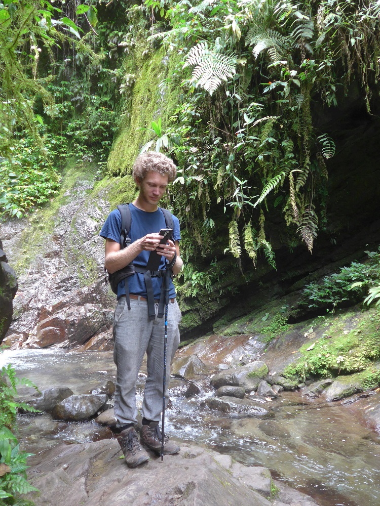
My wife and I are keen travelers. Close to home, it means exploring the nearby forests (even in Flanders, you can still add a path in every forest), but we are now back from a trip through South-America in a camper (blog) where we did over 32.000 km and navigated a year long with OsmAnd. You can believe me, the map is ready for navigation. In some towns, it might be more difficult, for example because turn restrictions aren’t often mapped and is the infrastructure sometimes pretty chaotic. During the voyage, I taught my wife to take notes and POIs in OsmAnd. After awhile, she started to question me, “shouldn’t we report that mistake here?”. And of course we created tracks all the time. This is especially handy for small hiking paths and areas that have a lot of clouds in the aerial images. In Peru, I believe that all main roads can use some extra “improve geometry” sessions too.
How do you map?
I do not specialise in anything when it comes to mapping. Because of that, and because I prefer software that does not require a manual, I never made the effort to learn JOSM. But Potlatch is more useful than most people believe. Most of my work is in empty areas. I scan aerial images for roads and settlements, without planning anything in advance.
On my smartphone, I only use OsmAnd. That can do everything. With some attention to detail, you can place most POIs rather accurately. When the map is too complex, or when I do not know the tags, or when I cannot edit it with OsmAnd, I make a note. By now, I am in the worldwide top-50 note users. It is fun to close notes, because you learn to map the most diverse features. I added my first turn restriction because there were several notes of this type in La Paz, Bolivia that were open for some months.
I once gave Mapillary a try, but with little success: the battery of my smartphone was drained, even with a connected charger. I could not run the navigation on the foreground and in a couple of hours all free space was consumed. I will keep trying though.
One of my first projects was to map the area around Coroico. I know the area very well, because I mapped the whole area before, on paper. Strictly speaking, this is armchair mapping and this is still what I do the most. But I only do this in areas that I know more or less, which does help to interpret the the satellite images.
Even though I’m late to the party, my first contributions were mainly new roads and paths. This is a good training school, you cannot make a lot of mistakes. You can’t really do this anymore in most of Europe of course, unless you are interested in paths in forests. Five years after my initial plan, I finally started to map that Bolivian village, Coroico. Probably the most detailed village in South America by now. In that region I scanned hundreds square kilometers for settlements and roads.
When I needed administrative boundaries for my project, I worked on this topic a bit. A lot of cleanup has been done all over the world since then. I received a lot of help from user Wambacher, who was interested in this topic to improve the quality of his boundary tool.
The usage of the map in South America made me realize how important and difficult it is to determine the road classification. In Belgium, we regard the state of a road as a detail, something like “is it a street with cobblestones or did they use paving stones “. In countries with a less developed road network, the first thing you want to know is whether or not you can even take the road with your vehicle. Although the data is there in some cases, there are not enough applications that use the data. I tagged several thousand kilometers of roads with surface tags in Peru and Bolivia. The data is almost complete in Argentina and Chili, and still there are no maps that optimally use this data.
Like many mappers, I guess I am a bit neurotic. It is satisfying to simplify the real, complex world into a few categories. Once you start with something, you want to get rid of the incompleteness in the map data. Be it a few small roads in the Amazone forest in Bolivia that are missing, or complete suburbs of El Alto. Before you realize it, you have been mapping roads for a month or two. And when that is finished, you are bothered by the fact that the landuse mapping in Flanders still has some white spots.
For me, mapping is something like filling in a sudoku. It requires some attention, but in a weird way it is very relaxing. And of course it is more useful.
I also believe that more data means that it will be used more, leading to more contributors. When OpenStreetMap has the best data of the road network in Bolivia — and guess what, it is — more organizations will use that data. On the State of the Map in Buenos Aires, there was a presentation from a Bolivian federal agency that protects the rainforest. They talked about how they use OpenStreetMap. They gave an example of a trip to the other side of the country, where OpenStreetMap showed him a “shortcut”, while everybody else told him to make a detour of 800 km. The idea that you, or someone like yourself, might have drawn that road, gives you a special feeling.
What are you most proud of as a mapper?
I can think of several things, but nothing is good enough to be really proud of. I usually lose interest in a topic when it is almost finished. Luckily that is no problem in OpenStreetMap, one day someone else will finish the job.
Do you contribute in other ways to OpenStreetMap?
Unfortunately, I am someone that produces a lot of ideas, but not a lot of products. OpenStreetMap culture is very much do-it-yourself, so reactions to these ideas aren’t always very positive. I tend to keep some ideas to myself, but often I can’t control myself. I am active on help.osm.org and forum.osm.org, both to assist or to seek assistance.
I am working on a project using Swing to represent the evolution of OpenStreetMap, at the level of regions around the world. The progress is slower than I hoped, even though I got a lot of help from several very kind people in the OpenStreetMap community. Especially Ben Abelshausen has been amazing. It was a wonderful experience to get the chance to present the project at State of the Map in Buenos Aires, even though I would have like to be able to present a more finished project (Video).
Being part of the overlander community for a year, I thought I needed to convince my fellow travellers to use OpenStreetMap. That was unnecessary: most of them navigate with OpenStreetMap anyway. Unfortunately, most apps do little to convert data users to data contributors. One app that does more is OsmAnd. But it isn’t the most user friendly one. That’s why I wrote a long blogpost on how you can use OsmAnd for your own needs and meanwhile improve the map too. That has been quite a popular post, but it is in dire need of an update now that version 2.0 is out. Of course it would be great if other apps implemented some of the feedback tools too. That isn’t too much to ask, no?
Another thing I would like to do is to organize a mapping party in my hometown Ghent. But I told you already about how my ideas take some time to materialize.
What are your ideas about growing the OpenStreetMap Community?
OpenStreetMap grows in a self-reinforcing virtuous circle. More data means more data usage. Data consumers can be converter to contributors. One time contributors can be converted to regular contributors. But the conversion rate is not constant. Apps such as OsmAnd have an higher conversion rate than Maps with Me. iD is supposed keep more mappers coming back than Potlatch did. Every contribution to the development of OpenStreetMap is part of this process, be it contributions to data, better usage of data, conversion of new users, better retention of new mappers
What is the key feature OpenStreetMap?
One of the strongest points is of course the flexibility and the freedom. We are only united by the common, ambitious, somewhat crazy idea to map the whole world. This allows everyone to chose their own topics, which leads to a general purpose map. The reason that som many procedures are so long winded and difficult to accomplish, is because procedures do not belong in the OpenStreetMap-world. There is a fantastic book that describes this phenomenom, Swarmwise by Falkvinge. The similarities between OpenStreetMap and the political movement is amazing. In short: start with one person with a slightly crazy (or ambitious) idea. Let this be executed by a group of people, that have to freedom to put their own accents. Furthermore, only let the execution be done by people that enjoy doing it, and that are not motivated by a reward. The book is also a practical guide. The challenges and opportunities that are described in the book, are the same as the OpenStreetMap community is facing. Recommended! And of course, free to [download](http://falkvinge.net/books/]
What are the challenges for OpenStreetMap?
For me, the biggest problem seems to be that the a lot of data is not used. Because you can map a wide variety of things, the map on the website only gives a limited introduction. I also fear that people that want to work around one specific theme, will opt for a separate database, because that is easier to work with. Nevertheless it is easy to create a rich community around a specific feature. Take e.g. a look at the huge success of iOverlander. This app allows the user to easily find campsites suitable for campers. Those sites are tagged with information such as the availability of internet, water, etc. Everybody can contribute, correct, review. OpenStreetMap loses the contributions of all those people and they miss the connection with a map that guides you to the site. My dream is an iOverlander app that only uses data from OpenStreetMap. When that app would be easily adaptable for other interest groups, you have a killer app that OpenStreetMap needs. I really like the idea of Coffeedex, but the topic might be a bit controversial for a first roll out.
How do you stay on top of OpenStreetMap news?
There are many channels, often with their own community. I can hardly follow all the mailing lists, besides the common one for Latin America. On the fora, there is not a lot of action {Editor’s note: except perhaps the German one]. The Help site is not known enough, although it is fantastic for specific questions. I even think I had to discover this website via Google. Furthermore there is OSMweekly, the diaries and the Reddit group. This can be better in my opinion. I like Reddit a lot, all readers contribute to the evaluation of each new post and each comment. The consequence is that the most important information automatically comes out. It would be great when all OpenStreetMap news sources could be combined like that.
Do you have contacts with other mappers?
Locally, I have met Ben and Jorieke several time. Thanks to the Meetups they organised in Ghent. Last year, I visited several of them and met several other mappers during those gatherings. I also keep close contact with Marco Antonio, one of the most renomated mapper in Bolivia.