Mapper of the Month: Marc Gemis
16.07.2015 - Jorieke
Marc Gemis is a 48 year old software engineer for a multi-national in Mortsel. His largest passion are his dogs, which he walks every day. His nickname, escada is the name of one of his dogs.
When did you discover OpenStreetMap?
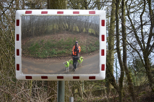
Marc and his dogs during a survey I have always walked a lot with the dogs. Until 2011 this were often the same walks, or walks that are described in the Lannoo-guides. We did not walk every weekend or evening because I also trained for and participated in agility-trails. Unfortunately my competition dog got injured and I had to stop with the sport. This meant that I would have more time for walks. Since I wanted to discover more of Belgium, I bought an outdoor GPS-device.
The idea was to download trails from dogsfriendly.be and follow those. From the moment that I found out that a good map for walking costed as much as the device, I started looking for cheaper alternatives. That’s I how I arrived at garmin.openstreetmap.nl. The map that was available via that site, seemed sufficient for my purposes.
Soon after installing the map on the device, I noticed that several smaller paths and tracks were missing in my home town. I subscribed to the Belgian maling list to learn how I could add those missing pieces. I got plenty of advice and one user, Polyglot also showed me which other data was missing and how that could be added. At that moment, he mainly talked about house numbers and bus stops.
Do you use OpenStreetMap yourself?
From the above, you can deduce that I use OpenStreetMap on my Garmin-device, from the moment I discovered it. Furthermore, I will always use openstreetmap.org when I want to let my friends know about the start position of a walk. From time to time I use Grapphopper or OSRM, to find out beforehand how long a trip will take. Both routing engines are now also available on the openstreetmap.org website.
Recently, I bought my first smartphone. The main reason was to allow me to start using OsmAnd for car navigation. During our hollidays I also used it as a guide in some towns.
How do you map?
As said in the introduction, I take the dogs out for a daily walk. This means that almost every day I find something new to map. The evening walks are usually close to home, while I make little trips all over Belgium during the weekend. Most of those trips are planned so I will discover a new part of some walking network. A walking network is layed out by the tourist office and allows each individual to create her own walk using short routes between numbered nodes. Those networks are one of the things I map.
The evening walks are totally different. Some of those walks were along calm paths, because the dogs enjoy them so much, while others were typical survey walks. That mean walking up and down each street and writing down information, mainly house numbers. I have collected several thousand house numbers that way. Since the Flemish house numbers can now be imported, I do not do this type of walks as much as before.
Because I keep learning about new stuff that can be mapped, even a walk that I have done several times before can expose new data. I also started to photograph those streets for Mapillary. Although that is not always easy, especially with 4 dogs on a lead and when the sun is going under.
Which Tools do you use?
From the first day on, I use a GPS-device to collect waypoints with information that I want to map later on. This works well for short texts, such as house numbers or objects that one meets frequently such as benches or garbage cans. I developed a whole “new” language based on abbreviations for this purpose.
Since a year or so, I take more pictures and rely less on waypoints. After all the relative position of objects is easier to see on photos. Furthermore, photos might contain details that you have missed while you were there. I take most pictures with a reflex camera. Sometimes, I try to use the smartphone as well. But in the end the GPS device and the camera are handier, since you can hang them around your neck and they are operated easily with one hand. I need the other hand to hold the leads of the dogs. I always upload the pictures to my smugmug-website, as an archive.
I immediately started mapping with JOSM for the improvement of the data. I have used the online editors, but they do not fulfil my needs. iD came in handy when I was working on some Maproulette tasks. Level0 was useful to quickly correct some tagging mistakes I made on a number of objects. I wrote a diary entry about that a while ago.
I have been working on correcting errors detected by Osmose and KeepRight, but I prefer to add new stuff that I surveyed. It seems to be that going out and collect data is more valuable as I have the impression that not a lot of people do that.
On the other hand, I enjoyed trying to fix the mistakes in my neighborhood listed by Check The Monuments. Probably, because I am more interested in that topic.
When I do not need my smartphone for navigation, I try to use it to take pictures with Mapillary. This allows me to take photos while I’m driving.
Where do you map?
I map almost exclusively in Belgium. Of course, I also map during my holidays abroad. I have also mapped a few villages in Mongolia and Uganda. That is very relaxing, just tracing houses and path from aerial images. However, I prefer to map locally, where I am familiar with the environment.
What do you map?
When I started mapping, I only payed attention to missing paths and the traditional Points of Interest (POI) such as shops, banks and mailboxes. It did not take long before I started mapping house numbers and bus stops. The list kept on growing when I added garbage cans, benches, picnic sites, life buoys, bicycle parkings etc.
Only during the last half year or so, I also started mapping underground fire hydrants (before that I did not know how to find them), street cabinets, markers for pipelines and the electricity cables for the local distribution. In the latter case, pictures found on Mapillary come in handy. The poles that hold those cables are often too small to be recognised on aerial images. That is perhaps the reason that they are not mapped a lot so far. There is a nice map on ITO that shows them though.
Of course, I also map the traffic signs for one ways, speed limits etc.
Since April 2014, I have been mapping the turn lanes in Flanders. Back then, I mapped a few of them, just to see the JOSM Lanes and Roads attributes style of Martin Vonwald in action. But I realised that this data could be very helpful for a car navigation program, so I continued mapping them, all over Flanders. One day I hope to be able to start in Wallonia. When I was mapping them for half a year or so, OsmAnd announced the support for this type of data. A few months later, the German community announced a project to focus on this data. They also developed a tool to view this data. It gives a nice feeling that others find this data also important.
During this virtual tour through Flanders, I occasionally saw some badly mapped crossings. However, in general the data seems complete and correct. On the other hand, I think that the data regarding the bicycle paths and lanes can be improved a lot. I have seen a lot of bad connections between the cycleways and the main roads. I also have the impression that a lot of oneway tags are missing on those cycleways, although that is hard to see on an aerial image of course. I fear that the navigation for cyclist is lacking in quality.
Thanks to the pictures on Mapillary, it is easy to map the destination signs. Finding the right picture can take some time, because the quality is not always good enough to read the signs. I hope that this will improve when more pictures become available. Those destinations are also used by OsmAnd, both on the display and as spoken navigation aids.
I also mapped many of the postal code boundaries. I had read on the German forum how they did it. Those relations turned out to be the solution to instruct Nominatim to return the correct postal code for an address. Other mappers have picked up this method and completed the postal code boundaries for Flanders. Unfortunately the administrative boundaries are often missing in Wallonia, so we cannot map the postal code boundaries.
Via Check the Monuments I discovered the historical places map. During my walks I had seen many signs for listed buildings, but never took the time to map them. In the meantime all listed buildings in Antwerp, Mechelen, Ghent and Bruges are mapped.
For each walk that I plan via a walking network, I also make a list of all historical buildings in the neighbourhood. I use a Python script that I wrote to generate a waypoint for each building. I find the list of those buildings, e.g in Sint-Pieters-Leeuw per town on wikipedia. When I am there, I check whether the building still exists and try to take a good picture of it. Those photos are placed on wikimedia. I also adapt the wikipedia page. Of course, all details about the buildings are added to OpenStreetMap.! Historical buildings and the walking network in Sint-Pieters-Leeuw
After meeting someone that had mapped the Japanese Garden in Hasselt during a meetup, I though that it would be neat to do something similar. So I visited the Open-Air Museum Middelheim (map) near Antwerp a couple of times in order to collect the data about the statues. In the meantime I should revisit the place to check the position of the statues, since they then to be moved from time to time. I also started a similar project to map all flowerbeds in the rose garden of the Vrijbroekpark in Mechelen.
Art in Middelheim viewed in OsmAndRose garden in umap
Why do you map?
I like to explore new areas. The surveys give me a good excuse to do that. And of course, mapping is more useful that endlessly watching YouTube movies of playing games. And I find it relaxing as well.
I also enjoy starting little projects and experiment with unknown tags, which is one of the reasons to start mapping new stuff. This keeps it interesting as well.
What is your biggest achievement as a mapper?
It is hard to choose between my contributions to the walking networks, the protected monuments and the turn lane mapping.
Do you do other things than just mapping?
I have given a few introductionary presentations, e.g on OpenBelgium 2015 and at some workshop organised by Nicolas Pettiaux at the ESI in Brussels.
Furthermore I have collected a few presets that I often use in JOSM with tagging specific for Belgium. Someone made that collection available under the name BENELUX. The name is not the best in the world, but I hope it is useful for some Belgian mappers.
I also made the original English translation for the Historic Places map and their JOSM preset. I still maintain the Dutch translation for that website. Not too long ago I translated a wiki page with Overpass examples from German to English. This should make it possible to use the page in a Google Summer of Code project.
I am also part of the Belgian Mapper of the Month Team. This idea was launched by Ben Abelshausen last winter. The purpose is to put another mapper into the spotlights every month. We hope that this helps to get to know each other better and improve the community feeling. The team looks for a mapper each month, writes him or her with the questions and makes the needed translations. In the end the text is available in Dutch and French on the Belgian OpenStreetMap website and in English in my diary. The latter is done to give more exposure to the idea.
From time to time I try to help people on the help website and on one of the fora.
I also made a few simple maps with umap. Via the “Doggy map”, I tried to introduce my friends from the dog world to OpenStreetMap, in the hope they would start mapping e.g. off leash areas. The map Fritures was an attempt to give more exposure to a typical Belgian form of fast food restaurant. I think it motivated some existing mappers to add some missing fritures in their neighbourhood or to adapt some incorrect tags.
Do you have ideas to expand the OpenStreetMap community?
I think we need more user-friendly applications that use “our” data. OsmAnd and and Telenav’s Scout (USA-only) are good examples of such programs. I think it is a pity that we do not have a possibility to plan walks along the walking route networks, something that is possible on the wandelknooppunt-website, but that is not using OpenStreetMap data. We have so much more data such a picnic sites, parkings, historical buildinds, taverns, etc. which might power a website that should allow a user to plan her walk much better in advance.
Too many website are still focussed on mappers and to do not pay enough attention to ordinary users. This seems like a problem to me, as most people just consume data, they do not produce data.
We might have to create some projects similar to the German “weekassignments” or the English “trimester assignments” for the Belgian mappers. Given the relative success of my posting about the umap with fritures, it might help to motivate the mappers.
What is the biggest feature of OpenStreetMap?
The large diversity of data that can be combined in interesting ways, see e.g. the article on the “Het Pad van Ad” by Polyglot that combines a walking route, public transport and tourism information.
What is the biggest Challenge for OpenStreetMap?
I have the impression that too many mappers are too focused on what they see on openstreetmap.org. But, there are so many websites and applications. We should promote all of them more. Maybe the German, French or Belgian approach is better. First explain the visitors of the website that it is about the data, and that this data is used on many different websites and in different apps. After that, you can still show them a large example map. Right now, this map is still compared with Google and too many people complain that their favorite feature is not rendered as they wish.
How do you stay on top of OpenStreetMap related news?
I try to follow about 15 mailing lists in 4 different languages. I learned a lot from the German forum. I discovered the Wochennotiz a few years ago and it seems to me that it is essential for anybody interested in OpenStreetMap. Luckily it is now also translated in several other languages. I also configured an alert on Google, which send me a mail message with new web pages related to OpenStreetMap. From time to time it contains a page that I did not see elsewhere.
Do you stay in contact with other mappers?
I am rather active on the Belgian mailing list. I still have a lot of email conversations with Polyglot, who taught me a lot in my early days.
I try to participate in all kinds of gatherings with other mappers, such as meetups or introduction days. Furthermore I organized a few hangouts to explain some basic JOSM functionality to novice mappers. Such an introduction is not always easy via email.
When I have problems to tag something, I might directly contact other mappers for help. Sometimes the specialist cannot be found in Belgium and I do not always need the discussions that a mail to a public list generates. So far, that experience was very positive, I assume the reason is that everybody wants to make the map better.
I have been contacted myself regarding a feature that I mapped incorrectly. I was not sure of what it was, but I added a tag to a photo of the “thing”. This allowed the specialist in that area to contact me, and tell me that it was a underground water reservoir for the fire department. I thought it was just an underground fire hydrant.
Anything else you want to share?
I would recommend all beginning mappers to subscribe to the mailing list and ask for advice before starting any serious work. Not all information is provided by the editors.