Mapper of the Month: Jean-Louis Stanus (Belgium)
01.05.2023 - Pierre Parmentier
His homepage and his contribution page.
- Hello Jean-Louis ! Would you like to briefly introduce yourself to our readers?
- I really enjoy collecting data in the field on foot, by bike or by car. I also enjoy hiking and caving. I like to travel and visit my family and friends all over Wallonia. This gives me many opportunities to contribute to the project. I live in Namur. On the other hand, my profession is GIS analyst for the city of Brussels at I-City.
- How and when did you get to know OpenStreetMap?
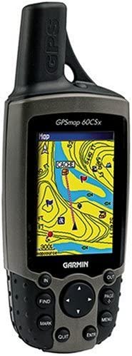
- I needed some free maps for my Garmin 60CSx. I then discovered that the data for these maps came from a collaborative project similar to Wikipedia. I lived in Frasnes-lez-Anvaing where there were only a few roads. With an extra GPS logger and my mountain bike, I was able to complete this region quite a bit.

- How do you use OpenStreetMap?
- When searching via Qwant Maps, when calculating routes with OsmAnd or isochrones on openrouteservices.org, when processing data for my work with overpassturbo and QGIS and also when planning walks with OpenTopoMap1 and Waymarked Trails2
- What kind of contributor are you and in which area do you map?
- At the beginning, I used my tracks on GPX with post-encoding in JOSM. Now I encode directly in the field with StreetComplete, Vespucci and OsmAnd.
- What are you mapping? Do you have a specialisation?
- I map cave entrances and karst phenomena as I do caving. Also facilities for children and their parents3, for people with reduced mobility (PRM)4, cycling and hiking routes12 in order to feed projects dedicated to these themes. I am also involved in importing buildings5 from PICC6 on areas I know well.
- What is your greatest achievement as mapper?
- I wouldn’t call it an achievement but rather patience to have imported all the buildings of the Bomel district in Namur7.
- Why are you mapping? What motivates you?
- I like to fill the gap, to see the evolution before and after. And also to understand OpenStreetMap data modelling.
- Do you have any ideas to expand the OpenStreetMap community, to motivate more people to contribute?
- Reach out to the specific needs and passions of people, e.g. tree lovers who want to collect information about trees in their area, organisers of sports events, etc.
- Do you have contact with other mappers?
- Yes, often by message. I read the mailing lists or articles on Twitter. But unfortunately, it’s often difficult to get to events on weekday evenings.
- What is in your view the greatest strength of OpenStreetMap?
- Its strength is in providing mapping for countries that cannot afford it or have suffered a natural disaster8 as well as enabling environmental and social issues34 that are not always well covered by public institutions or companies.
- What are the largest challenges for OpenStreetMap?
- Firstly, to remain independent. Secondly, to evolve the data model to be compatible with new technologies.
- How to do stay on top of news about OpenStreetMap?
- Twitter and mailing lists.
- To conclude, is there anything else you want to share with the readers?
- Thank you for the contributions and the exchanges which help to get more experience and improve the project.
Thank you, Jean-Louis, for this interview.
Translated from French by Claire Muyllaert and Pierre Parmentier with the help of www.DeepL.com/Translator.
-
PICC : Projet Informatique de Cartographie Continue, en Wallonie ↩